Low-Cost LiDAR scanner for Indoor Mapping
a prototype of an inexpensive and more flexible design of a 3-Dimensional (3D) LiDAR scanner with the use of a singlepoint ranging LiDAR sensor is presented. The design consists of an electromechanical setup, an optical sensor and a microcontroller for data acquisition (TF-Luna Range Sensor and Arduino Module).
Engineered a cost-effective LiDAR-based scanning system aimed at enhancing the affordability and accessibility of indoor mapping solutions. This project involved developing a custom hardware-software integration for 3D point cloud generation, focusing on precision, efficiency, and cost-effectiveness.
Key Contributions:
LiDAR Hardware Integration:
- Selected and integrated a 2D LiDAR sensor with custom-built mechanical assemblies to enable continuous 360 degree scanning.
- Designed a rotating platform driven by a stepper motor for controlled scanning, ensuring comprehensive coverage of indoor environments.
Data Acquisition and Processing:
- Implemented a data acquisition pipeline using microcontrollers and interfaces to capture LiDAR distance measurements in real-time.
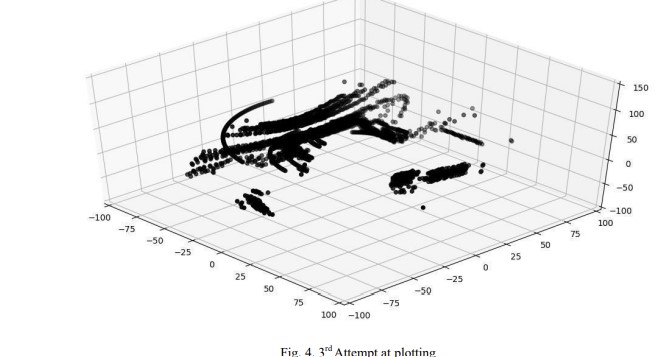
- Developed algorithms to convert 2D LiDAR data into a 3D point cloud, enabling accurate spatial representation of indoor environments.
Cost Optimization:
- Prioritized affordability by utilizing readily available components and efficient design practices, reducing the overall system cost compared to commercial alternatives.
- Conducted a comparative analysis against existing solutions to validate the cost-performance trade-off.
System Calibration and Testing:
- Calibrated the LiDAR scanner for optimal accuracy in distance measurement and angle estimation, achieving an error margin of less than 2% in controlled environments.
- Conducted extensive testing in diverse indoor settings to ensure reliability and adaptability.
Software Development:
- Developed a user-friendly interface to visualize the generated 3D point cloud data in real-time, aiding in navigation and analysis.
- Integrated mapping outputs with open-source platforms for further processing and analysis.


Impact: Provided an accessible solution for applications in robotics, indoor navigation, and environment mapping. Significantly lowered the barrier to entry for small-scale researchers and developers by reducing hardware costs. Demonstrated the potential of low-cost solutions for democratizing advanced technologies in spatial computing.